Kauaʻi or Kauai, known as Tauaʻi in the ancient Kaua'i dialect (pronounced /ˈkaʊ.aɪ/ in English and [kɔuˈwɐʔi] in Hawaiian) is geologically the oldest of the main Hawaiian Islands. With an area of 562.3 square miles (1,456.4 km2), it is the fourth largest of the main islands in the Hawaiian archipelago, and the 21st largest island in the United States. Known also as the "Garden Isle", Kauaʻi lies 105 miles (170 km) across the Kauaʻi Channel, northwest of Oʻahu. This island is the site of Waimea Canyon State Park.
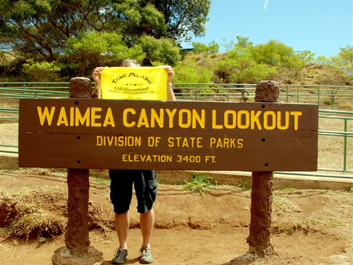
 Kauaʻi's origins are volcanic, the island having been formed by the passage of the Pacific plate over the Hawaii hotspot. At approximately six million years old, it is the oldest of the main islands. The highest peak on this mountainous island is Kawaikini at 5,243 feet (1,598 m).[7] The second highest peak is Mount Waiʻaleʻale near the center of the island, 5,148 feet (1,569 m) above sea level. One of the wettest spots on earth, with an annual average rainfall of 460 inches (1,200 cm), is located on the east side of Mount Waiʻaleʻale. The high annual rainfall has eroded deep valleys in the central mountains, carving out canyons with many scenic waterfalls. On the west side of the island, Waimea town is located at the mouth of the Waimea River, whose flow formed Waimea Canyon, one of the world's most scenic canyons, and which is part of Waimea Canyon State Park. At 3,000 feet (914 m) deep, Waimea Canyon is often referred to as "The Grand Canyon of the Pacific". The Na Pali Coast is a center for recreation in a wild setting, including kayaking past the beaches, or hiking on the trail along the coastal cliffs.


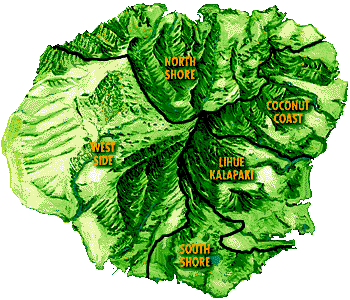
The city of Līhuʻe, on the island's southeast coast, is the seat of Kauaʻi County and the second largest city on the island. Kapaʻa, on the "Coconut Coast" (site of an old coconut plantation) about 6 miles (9.7 km) north of Līhuʻe, has a population of nearly 10,000, or about 50% greater than Līhuʻe. Waimea, once the capital of Kauaʻi on the island's southwest side, was the first place in Hawaii visited by British explorer Captain James Cook in 1778. Kauaʻi is home to thousands of wild chickens, who have few natural predators. Kauaʻi's chickens originated from the original Polynesian settlers, who brought them as a food source. 1992's Hurricane Iniki may have caused an indirect change in Kauaʻi's ecosystem, increasing the chicken population.
Kauaʻi is home to the U.S. Navy's "Barking Sands" Pacific Missile Range Facility, on the sunny and dry western shore.


 There is no known meaning behind the name of Kauaʻi. Native Hawaiian tradition indicates the name's origin in the legend of Hawaiʻiloa — the Polynesian navigator attributed with discovery of the Hawaiian Islands. The story relates how he named the island of Kauaʻi after a favorite son; therefore a possible translation of Kauaʻi is "place around the neck", meaning how a father would carry a favorite child. Another possible translation is "food season."

 |
| A view of the Nā Pali coastline from the ocean. It is part of the Nā Pali Coast State Park which encompasses 6,175 acres (20 km2) of land and is located on the northwest side of Kauaʻi. |
 |
| A view of the Hanalei Valley in Northern Kauaʻi. The Hanalei River runs through the valley and 60% of Hawaii's taro is grown in its fields. |
The city of Līhuʻe, on the island's southeast coast, is the seat of Kauaʻi County and the second largest city on the island. Kapaʻa, on the "Coconut Coast" (site of an old coconut plantation) about 6 miles (9.7 km) north of Līhuʻe, has a population of nearly 10,000, or about 50% greater than Līhuʻe. Waimea, once the capital of Kauaʻi on the island's southwest side, was the first place in Hawaii visited by British explorer Captain James Cook in 1778. Kauaʻi is home to thousands of wild chickens, who have few natural predators. Kauaʻi's chickens originated from the original Polynesian settlers, who brought them as a food source. 1992's Hurricane Iniki may have caused an indirect change in Kauaʻi's ecosystem, increasing the chicken population.
Kauaʻi is home to the U.S. Navy's "Barking Sands" Pacific Missile Range Facility, on the sunny and dry western shore.
No comments:
Post a Comment